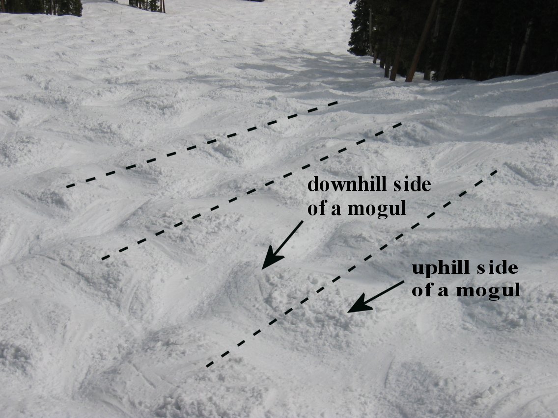
 from this point provided by David Bahr that
also shows the characteristic self organization of the bump field from
repeated skiing. The trees in the upper left hand corner mark the gap
leading to the Feebleminded.
 Motivation These data were assembled to explore a nontrivial geographic dataset in R. The challenge is to adapt spatial statistical methods typically for several hundred locations to the approximately 28K grid points for elevation. With a rigorous surface estimate it is easy to generate statistical estimates for the derivatives of the elevation surface. The key to making these calculations feasable is to induce many zeroes in the large covariance matrices that define the equations for the surface estimate. Here we use the compactlly supported Wendland covariance function to achieve this. This form is similar to a thin plate spline radial basis or a Matern covariance function near the origin but away from zero the Wendland function becomes identically zero beyond a finite range. Given a covarince matrix that has many zeroes one can use sparse matrix methods to reduce the amount of calculations needed to do the linear algebra required for the estimate.The SPAM package,required by fields, implements these matrix methods.
Guide to run:
This run is quirky and has quite a bit of variety. It starts with a
nearly flat trail under the SuperGauge lift. This part will give you
time to adjust your gear and get ready for the scary parts. After
crossing a summer service road, the terrain drops away into a nice
bowl called Sluice Box. Traversing to skiers left there is usually a
bit more powder and some interesting trees to negotiate. But hang a
sharp right turn to descend into the bowl. This drop involves terrain
with big steep bumps and most people will consider taking a few turns
down this face to control their speed. Stay to your left coming out
of sluice box otherwise you will be consigned to ski Sleeper with the
masses. The middle part of the run is much less steep going over some
washboards and then enters a narrow cut in the woods that was made for
the SuperGauge lift line (Supergauge Trail). Although not clear from
the DEM, this trail also has slope to skiier's right along with a
general slope down the lift line. The right side typically has deeper
thick snow that is satisfying to plow through if you have enough
speed. There are one or two tight steep spots on this trail but then
this route opens onto a wide and gently sloping area opposite the top
of the Pony Lift. If you want to practice your bump skiing technique
this is now a friendly environment to do it. This is also a chance to
escape to the easier blue and green runs served by Pony. Do this
either right at the top of where you see the pony lift or you can ski
a bit more of the steep part and then traverse over Rainbow Cut
through some trees.
The classic way to ski the steep part of Riflesight is to swing to skiier's right and stop at the knoll just before the proper beginning of the steep Riflesight Notch pitch.
Here is a view  from this point provided by David Bahr that
also shows the characteristic self organization of the bump field from
repeated skiing. The trees in the upper left hand corner mark the gap
leading to the Feebleminded.
Plan your descent through the bumps and go for it. Bump skiing does not get much harder than this. This pitch is a long one and typically does not have much loose snow so technique is important even if you decide to traverse across to the left to lose some speed. Bear to to skiier's left at teh bottom of this pitch and finish out the run on Feebleminded. Look for good snow on the sides. However you get down this run you should feel like you skiied something hard and a bit wild -- and done it in view of all the folks comfortably sitting on the SuperGauge chairs. You will not find many other black runs that will stretch you like Riflesight Notch.
Some previous work
Dale Greer has assembled a nice set of
perspective maps with slope color coding on his site
3dskimaps. It is an impressive effort
and appears to leverage more conventional GIS software. The details
for Riflesight Notch also exhibit the triple of steep portions that
turned up in the Kriging/DEM analysis given below.
David Bahr in the Department of Computer Science at Regis University, Denver, CO has used Riflesight Notch as a study site for understanding how bump (also known as moguls) fields have a tendecy to self organization to self organize in regular rows and columns. See his site for a sequence of time lapse pictures that illustrate how the bumps move uphill due to skiier carving. There is also a discussion of how this phenonema is related to self organization and computer science.