IMAGe research projects
-
Spatial Distributions of Precipitation Events from Regional
Climate Models
Nathan Lenssen
A summer intership project June-August 2010 mentored by
Doug Nychka
NCAR has an active research program in the analysis of large numerical
simulations of the climate over North America. What is unique about
these simulations is their high resolution (50 km) which approaches the
scale needed to assess local effects of climate change. The goal of this
research is to quantify the validity of such models when compared to
observed data. A simple statistic, akin to the spatial cumulative
distribution function, is used to summarize different climate models'
ability to localize precipitation events.
|
 |
|
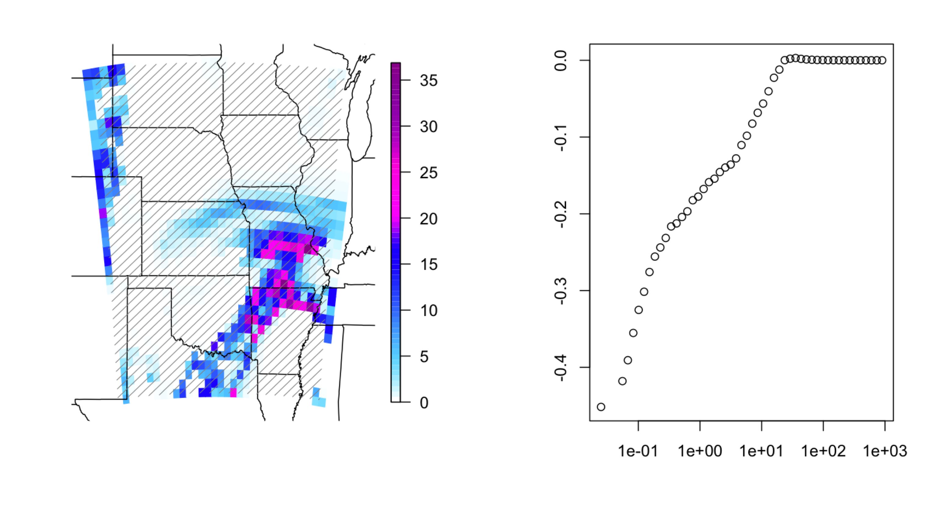
(Left) Simulated 3 hour precipitation (mm/hr) of the
Candian Regional climate model from the North American Regional
Climate Change Program (NARCCAP).
(Right) The proportion of grid cells
are are below a specific level of precipitation.
|
Last modified: Mon Nov 1 16:09:54 MDT 2010
